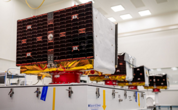
Knowing where one is on the planet is something taken for granted nowadays thanks to the PNT (Positioning, Navigation and Timing) constellations orbiting Earth. There are four major constellations that provide global coverage: Global Positioning System (GPS, USA), GLONASS (Russia), Beidou (China) and Galileo (Europe). India’s Indian Regional Navigation Satellite System (IRNSS) provides regional coverage. The satellites in these constellations mostly occupy a Medium Earth Orbit (MEO), BeiDou also operates in GEO.

Illustration highlighting medium altitude orbits around Earth, from Low Earth to the lowest High Earth orbit (geostationary orbit and its graveyard orbit, at one-ninth of the Moon’s orbital distance). Source – Wikimedia, Medium Earth orbit
Global Positioning System
The Navstar Global Positioning System grew out of the U.S. Navy’s Timation program and the U.S. Air Force’s Program 621 B established to develop a satellite-based passive ranging system. The first navigation experiment involving a Navy Transit satellite, conducted in 1960, provided two-dimensional data. The GPS program entered its concept validation phase in 1974. The first Navstar satellite launch followed four years later. In all, four Navstar satellites were launched in 1978, with each designed primarily to test the onboard clock and frequency standard system. Since this time, there have been three generations of GPS spacecraft.
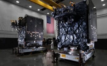
The current (launching now) and future iterations of the GPS constellation are known as GPS-III and GPS-IIIF respectively. These are both produced by Lockheed Martin using their LM2100 satellite bus.
GLONASS
At the end of the 1960s, the Russian military identified a need for navigation satellites. Development of such satellites lasted throughout the 1970s, and the first satellite was launched in 1982. Completion of the full 24-satellite constellation was originally scheduled for 1987; however, it was not completed until 1995. In the chaos of post-Soviet Russia, the system quickly fell into disrepair, and by 2002, only eight satellites remained operational. In the early 2000s, Russian President Vladimir Putin vowed to resurrect the system, and Russia deployed its first GLONASS -M variant in 2001.
The last GLONASS-M variant launched in 2022. The current satellites being launched are known as the GLONASS-K1 and -K2 variants with a reported -KM variant on the way. ISS Reshetnev produces these spacecraft.
Galileo
Galileo traces its roots back to 1994, when ESA, the European Commission (EC), and the European Organization for the Safety of Air Navigation (EUROCONTROL) agreed to develop the Global Navigation Satellite System (GNSS-1), better known as EGNOS. Following a mandate from the Council of Ministers of the European Union, the EC took the program a step further to develop a full satellite navigation system, dubbed Galileo. ESA first committed funds to the program in May 1999.
The U.S. was originally opposed to the implementation of Galileo because it could possibly interfere with GPS signals and would take commercial business away from GPS. Despite American pressure, Europe decided to implement the system with an eye on boosting the economy and becoming independent of the U.S. system. Galileo; however, was designed to be compatible with GPS and accommodate future updates to the GPS constellation.
OHB has produced the main FOC (Full Operational Capability) satellites which are still launching. In January 2021, ESA announced the award of a contract for Galileo Second Generation satellites. These are to be built by Airbus Defence and Space and Thales Alenia Space (six satellites each).
BeiDou
The BeiDou Navigation Satellite System (BDS) is a Chinese-developed global navigation satellite system (GNSS) that provides precise positioning, navigation, and timing services. Initiated in the late 1990s, BDS underwent a three-phase development process, culminating in full global coverage in 2020.
BeiDou is now a fully operational GNSS system, with a constellation of approximately 60 satellites according to the Test and Assessment Research Center of China Satellite Navigation Office . It offers a variety of services, including open service, authorized service, and restricted service. The open service is available to all users, while the authorized and restricted services are intended for government and military users.
The current BeiDou satellites, mostly built by the China Aerospace Science and Technology Corporation (CASC & CAST), are BeiDou-3 spacecraft. The last of these BeiDou-3 satellites launched on September 18. The next variant and upgrade of the BeiDou constellation will be BeiDou-4. It is unknown at this time when these newer spacecraft will launch but they are likely in production.
Forecast & Historical

Note: Estimated build years; “All Others” include Airbus & Thales (Galileo Second Generation), Boeing (GPS Block IIF, 2014), and future Follow-On programs
The importance of navigation for both civilian and military purposes cannot be overstated. The ability to know where one is has become a cornerstone of modern society, the programs listed above have made this a reality. Production of satellites to maintain these constellations will therefore remain steady as the capability they provide is in the national interests of these respective countries.

Carter Palmer has long held a keen interest in military matters and aviation. As a FI's space systems analyst he is responsible for updating the reports and analyses within the Space Systems Forecast – Launch Vehicles & Manned Platforms and Space Systems Forecast – Satellites & Spacecraft products.